Walking Irelands Mountains
Routes in the Mourne Mountains
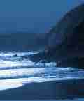
[Walking Irelands Mountains published by Appletree Press contains many hiking routes through the mountains detailed in this article as well as many others throughout the island.]
The Mournes are a small but highly varied and impressive granitic group. The eastern side has tor-topped steep-sided peaks, good ridges and long, deep valleys (routes 32 to 34, 40,43), but the west is more plateau-like (routes 35, 41, 42). Unusually for an easily accessible area, there are few forestry plantations on the higher slopes. The Mournes rise to 850 metres/2,796 feet at bulky but unimpressive Slieve Donard (route 33). Much more memorable are Slieve Bearnagh (739 metres/2,396 feet) and Slieve Binnian (747 metres/2,449 feet) (routes 32, 34, 43). The good bus service facilitates rewarding end-to-end walks of the eastern Mournes in a not too strenuous day (route 34). Navigation on the higher peaks is greatly aided by the ubiquitous Mourne Wall which encloses the central Silent Valley and traverses all the main peaks, but care should be taken not to confuse it with other similar walls.
These mountains are much used by walking groups and this has strained the patience of farmers. Care should be therefore be taken to avoid trespass over farmland and to keep to the network of paths, which are well indicated on the maps, particularly the 1:25,000 map.
The B27 road which runs through the Mournes gives a good introduction by car to the range. There is plenty of accommodation available around the Mournes, where Newcastle is a large centre with lots of varied visitor accommodation. The Mournes are well served by bus, with a route circumnavigating close to the higher Mournes (in July and August only) being particularly useful.
Route 32: North High Mournes - Slieve Bearnagh
Map 29 (1:50,000) or "Mourne Country" (1:25,000).
Start at car park on left off B189 (J 312314). Take Ulster Way south for one kilometre, continue south-east to Hare's Gap (heading for prominent gate in wall where paths diverge), follow Mourne Wall to climb Slieve Bearnagh (large tors); when descending, keep clear of cliffs on right. Climb Slieve Meelmore (tower) keeping to right-most of two walls; climb Slieve Meelbeg. Leave walls to descend its north-west spur to Ulster Way and take Way to start.
Distance: 11 kilometres. Climb: 850 metres.
Time: 3.75 hours.
Route 33: North High Mournes - Slieve Donard
Map 29 (1:50,000) or "Mourne Country" (1:25,000).
Start at Tollymore car park (J 344326). Walk forest paths to forest edge at] 332312. Climb Luke's Mountain, Slievenaglogh, follow Mourne Wall east to Slieve Donard (tower, trig pillar) and south for one kilometre. Take Brandy Pad (path) north-west to Hare's Gap, climb Slievenaglogh following wall, retrace steps.
Distance: 18 kilometres. Climb: 1,150 metres.
Time: 5.5 hours.
Route 34: South High Mournes - Slieve Binnian
Map 29 (1:50,000) or "Mourne Country" (1 :25,000).
Start at car park on north side of C313 (J 345219). Walk track north for 800 metres, then follow Mourne Wall to Slieve Binnian (large tors); walk to North Tor, Slievelamagan, col towards Cove Mountain, Cove Lough, path/track traversing Annalong Valley to start. There are several opportunities to vary the walk by heading east to the Annalong Valley, but beware of cliffs en route to this valley. The route can also be easily modified to finish in Newcastle.
Distance: 14 kilometres. Climb: 950 metres.
Time: 4.5 hours.
Route 35: West Mournes
Map 29 (1:50,000) or "Mourne Country" (1 :25,000).
Start at footbridge at J 264205 on Sally Brae Road, reached by turning right off C313, 0.7 miles south-west of Attical. Take path which starts just south of footbridge and runs west. Cross ford on river after 500 metres, then continue north-west initially on path, to Eagle Mountain. Follow Mourne Wall to Pigeon Rock Mountain, take spur south, then descend south-west to track. To avoid private property near start, divert right, thus following stone wall.
Distance: 14 kilometres. Climb: 750 metres.
Time: 3.5 hours.
Information extracted from Walking Irelands Mountains: a guide to the ranges and the best walking routes by David Herman, published by Appletree Press.
|
|