 |
Search the site:

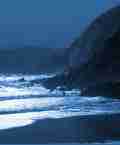
KERRY & West Corkit was odd how, standing in mist among ecclesiastical-looking cairns [on Brandon] , we looked down and saw that Smerwick and Ballyferriter were enjoying a day of sunshine, Brandon Head was rainy, and Mount Eagle was in cloud. Climbing west of Dingle is deceptive, a succession of false summits, each windier than the last; but from the heights of Brandon the whole peninsula is spread out like a topographical map, path and road, cove and headland.The mountains of Kerry (and those of West Cork which are included here) are a large and complex tangle of predominantly old red sandstone rock. To make some sense of them, the region is considered here in three sub-regions, Dingle, Iveragh and Beara, corresponding to the three main peninsulas and their mountainous hinterlands. Each of these three, where necessary, is further broken down into individual ranges. The only general comments that might usefully be made about Kerry are that it contains most of the highest mountains in Ireland, including all but two of the Munros; that the whole region is remote and because of the long, jagged peninsulas difficult to access; that the sea or its inlets are never far away; that good centres are easier to find in the east than in the remote west; and lastly, and perhaps most importantly, that the whole region is so attractive that you are unlikely to regret the effort of getting there! The Dingle Peninsula, the northmost of the Kerry peninsulas, is divided by the two roads which cross it diagonally into three mountain groups, which are more scenic and wilder as one progresses westward. The Slieve Mish range in the east rises to 852 metres/2,796 feet at Baurtregaum (routes 106, 121). These hills are very dull and bland on their southern slopes, but the northern side facing Tralee Bay is much sharper and more inviting. Immediately west is the Stradbally group (route 107), a range of fine peaks. Its northern edge, where Beenoskee rises to 826 metres/2, 713 feet, is especially attractive. Its southern aspect is much duller, degenerating to bogland in places. The Brandon group to its west takes many of the walkers who would otherwise visit this area. The Brandon group, of which Brandon itself (routes 108, 122) is the most notable and highest at 952 metres/3, 127 feet, is undoubtedly the main attraction of the peninsula. Facing north-west in stern cliffs to the ocean and dominating the western skyline in jagged outline, this massif (especially its eastern and northern sides) is most striking. Routes from the east, which take in a string of paternoster lakes in rugged corries, are exceptionally scenic. Incidentally, this far western end of the peninsula (route 123) is exceptionally rich in archaeological remains and is one of the few remaining strongholds of the Irish language. The next 'Kerry' extract can be found here : Part 2
|
[ Back to Top ]
All Material © 1999-2009 Irelandseye.com and contributors
