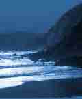
KERRY & West Cork
it was odd how, standing in mist among ecclesiastical-looking cairns [on Brandon] , we looked down and saw that Smerwick and Ballyferriter were enjoying a day of sunshine, Brandon Head was rainy, and Mount Eagle was in cloud. Climbing west of Dingle is deceptive, a succession of false summits, each windier than the last; but from the heights of Brandon the whole peninsula is spread out like a topographical map, path and road, cove and headland.
Paul Theroux, Sunrise with Sea monsters 1985
Dingle
Route 106: East Dingle - Slieve Mish
Map 71 (1:50,000), preliminary edition.
Start at end of tarmac on side road off N86 (Q 741110). To get there, drive 5.1 miles west from Blennerville Bridge to hump-backed bridge and then take second road left (narrow!). Park considerately at turning point at end. Take initial path south, then leave it after 200 metres or so to cross river on left, climb Scragg, point 819 metres, Baurtregaum (trig pillar). Walk south-west to saddle and climb Caherconree. Walk north-west for 200 metres to avoid cliffs, then descend north to Gearhane (point 792 metres) and continue along its north-east spur to rejoin outward route.
Distance: 11 kilometres. Climb: 950 metres. Time: 4 hours.
Route 107: Central Dingle
Map 70 (1 :50,000), preliminary edition (forested area shown south of Stradbally greatly exaggerated).
Start at Stradbally village (Q 592122). Take laneway to east of Courtney's pub and continue south along river valley to Lough Acummeen, climb Stradbally, Beenoskee (trig pillar), walk south-west for 500 metres, then north-west to climb Coumbaun, Beenatoor. Descend north spur, veering right off it to walk down river valley and reach road 2.5 kilometres west of start.
Distance: 13 kilometres. Climb: 1,000 metres. Time: 4.25 hours.
Route 108: West Dingle - Brandon
Map 70 (1 :50,000), preliminary edition (area shown forested around Q 4711 greatly exaggerated).
To get there from Cloghane take minor road south-west for 2.2 miles to cross bridge over Owenmore River and start at next farm entrance on right (Q 490084). Walk path initially north-west, keeping on north-east side of pater-noster lakes and join main path near head of pater-noster corrie. Follow path to Brandon (trig pillar, ruins) turning left where steep ground eases. Walk south-east following wall and with cliffs on left, to Brandon Peak. Walk to Gearhane (narrow section of ridge rather than peak), descend generally south-east with cliff edge/steep ground on left to reach road at about Q 488077 (safeguard young trees on final descent). Walk road one kilometre to start.
Distance: 12 kilometres. Climb: 1,100 metres. Time: 4.25 hours.
The next 'Kerry' extract can be found
here : Part 5
Information extracted from Walking Irelandís Mountains: a guide to the ranges and the best walking routes by David Herman, published by Appletree Press.
|
|


