 |
Search the site:

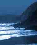
MAYOStanding on the edge of Croaghaun, it was difficult to believe that I was now on the edge of the highest sea cliffs in the British Isles, where the mountain suddenly comes to an end and falls 1,950 feet to the sea in a series of vast, rocky, partly grass-grown slopes. It was difficult to believe because beyond twenty feet in any direction, up, down, or sideways, it was impossible to see anything at all. All I could hear was the sea sighing far below, and the dismal crying of the gulls.Mayo is a large county with several groups of mountains; unusually in Ireland, some of them take the form of small, isolated massifs. The hills are generally surrounded by large expanses of dreary bogs. Though there are massive and very remote sea-cliffs on the north coast (route 91), bounded inland by extremely dull mounds, the main mountain areas are around Clew Bay and in the very south of the county. Let's work clockwise round Clew Bay starting with Achili Island, which is joined by a bridge to the mainland. One mountain here, Croaghaun (688 metres/2, 192 feet) boasts as many as five corries, some tucked precariously into its tremendous northern sea-cliffs (routes 76, 87). The mountains themselves, grouped in a few small, discrete areas, are otherwise mundane. Corraun, a small peninsula close to Achill, also has a few impressive carries on its northern side but is not otherwise over-exciting. The Nephins (routes 77 to 79,88,89) are more formidable. They form a rough quartzite triangle rising for the most part from blanket bog and monotonous forestry plantations which impede or bar access. The northern end of this range is undoubtedly the most remote in Ireland, with some areas being eight kilometres/five miles from an approach road (forestry roads come closer but may be barred to vehicles). This not very impressive distance indicates just how accessible all Irish mountains are; however, the time required to cover this distance is another matter. The Nephins are generally smoothly rounded, wet and bland but drop steeply in places into corrie lakes, especially at east-facing cliffs near its remote northern end. Corranabinnia (716 metres/2,343 feet) (route 77) is the climax of a good and comparatively accessible horseshoe from the south. Nephin itself (807 metres/2,646 feet), the highest peak, is a massive isolated mound far from the rest of the range and hardly worth climbing. A rough and very lonely path, the Bangor Trail, runs north for thirty kilometres/nineteen miles at low level through the Nephins, along their flanks and into dreary and wet moorland to their north. The next 'North Connaught' extract can be found here : Part 2
|
[ Back to Top ]
All Material © 1999-2009 Irelandseye.com and contributors
