 |
Search the site:

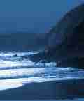
MAYOStanding on the edge of Croaghaun, it was difficult to believe that I was now on the edge of the highest sea cliffs in the British Isles, where the mountain suddenly comes to an end and falls 1,950 feet to the sea in a series of vast, rocky, partly grass-grown slopes. It was difficult to believe because beyond twenty feet in any direction, up, down, or sideways, it was impossible to see anything at all. All I could hear was the sea sighing far below, and the dismal crying of the gulls.Route 79: Central Nephins Map 6 (half-inch) - Bangor Trail Guide also useful; maps 30 and 31 (1 :50,000), Discovery Series, when available. Start at Treanlaur Youth Hostel (F 972013). Walk north on Bangor Trail to post 14, follow forest track upstream and cross bridge (footbridge at about F 967055, if in place, may also be used). Climb point 937 feet through scattered trees. Keep to high ground, avoiding some forestry, to climb 1,336 feet and Nephin Beg. Descend its south-west spur to Bangor Trail and follow it south-east, veering right off it to reach road on west side of Sramore River. Road to start. Route 89 below may be used as an escape route. Distance: 24 kilometres. Climb: 750 metres. Time: 6 hours. Route 80: Croagh Patrick Maps 10 or 11 (half-inch). The boundaries of the Discovery Series maps fall awkwardly in this area, which is, anyway, an easy area in which to navigate. Start at prominent car park at Murrisk (L 920824). Take pilgrim track to top of Croagh Patrick (ecclesiastical buildings), climb Ben Goram, descend towards Leckanvy reaching track on right bank of unnamed stream flowing north to Leckanvy. Keep on this bank to Leckanvy to avoid worst of high vegetation near village. Road to start. Distance: 12 kilometres. Climb: 800 metres. Time: 3.75 hours. Route 81: Mweelrea Map 37 (1 :50,000), Discovery Series. Start on R335 north of Doo Lough (L 829695). Walk southwest to cross stream near Doo Lough and ascend steep ground to right of corrie to reach summit plateau near Ben Bury (scrambling near top avoidable, from start only, by walking into corrie and taking path ascending left to right to reach plateau at lowest point of corrie rim). Walk to Mweelrea, retrace steps to edge of corrie and walk east with cliffs on left. Keep steep ground on left to continue downwards, avoiding subsidiary spur diverging right, to ford stream at ruin at L 846666. Walk road to start. There is an easier approach to Mweelrea from Delphi Adventure Centre, just south of Fin Lough. Distance: 16 kilometres. Climb: 1,050 metres. Time: 6.5 hours (including I hour for scrambling and steep descent). Route 82: Ben Gorm Map 37 (1:50,000), Discovery Series. Start at car park near Ashleagh Falls (L 894645). Take track upstream a short distance, then walk spur west to Ben Gorm, Ben Creggan (693 metres). Descend spur east for two kilometres, walk directly to start crossing two streams (very wet ground, so there and back to Ben Creggan is advisable after wet weather). Distance: 11 kilometres. Climb: 800 metres. Time: 3.5 hours. Route 83: Sheeffry Hills Map 37 (1 :50,000), Discovery Series. Start at car park on R335 (L 844677). Climb north to point 772 metres. Continue east on narrow ridge to point 762 metres (trig pillar). Walk one kilometre east to two small lakes, then descend south-east spur, keeping forestry on right to meet side road. Walk 5 kilometres on road to start. Walk can be extended to point 742 metres, descending on south-east spur, keeping forest on right. Distance: 12 kilometres. Climb: 800 metres. Time: 4 hours. Route 84: Devilsmother Maps 37 and 38 (1:50,000), Discovery Series; maps 10 or 11 (half-inch) may suffice. Start around Glennacally Bridge on N59 (L 936657). Choose convenient point to climb Devilsmother (twin summits) on north spur. Descend north-east, east to col, climb point 617 metres/2,039 feet and contour anti-clockwise past Maumtrasna to descend steep ground on west-running spur (Luga Kippen) to road. Distance: 15 kilometres. Climb: 950 metres. Time: 4 hours. The final 'Mayo' extract can be read here. Previous 'Mayo' extracts can be read here: Part 1 | Part 2 | Part 3 |
|
[ Back to Top ]
All Material © 1999-2009 Irelandseye.com and contributors
